
Introduction
We recently visited the Warford Ranch Volcano which is a low shield volcano that is part of the Sentinel-Arlington volcanic field of southwestern Arizona. It is about 3 million years old. It was a favorite field trip destination of Prof. Ronald Greeley. Shelby Cave worked on the Sentinel-Arlington field for her Ph.D. dissertation under the supervision of Prof. Greeley and after his passing she worked with Prof. Amanda Clarke.
Google maps location for Warford Ranch (NW of Gila Bend, AZ).Professor Clarke is teaching the Advanced Field Geology course and she took the group to Warford Ranch volcano to examine its volcanology. I did some UAS-mapping to help with the documentation. This blog entry presents some of the products of the overflights with our Mavic Air and Phantom 4 Pro.
Oblique overviews
I flew the Mavic Air high to get some views over the volcano to assess its general form and the relation to adjacent landforms and geology.


sUAS mapping
Along with the free flying overviews, I flew in mapping mode (using the PX4D mapper app) over most of the volcano taking 1778 images in mapping mode. I processed those in Agisoft Metashape to produce a colored point cloud, digital elevation model, and orthophoto. The latter two can be the basis of more mapping in ArcMap.
Tour of the data and its processing in Agisoft Metashape and ArcMap.Map downloads


Map data downloads
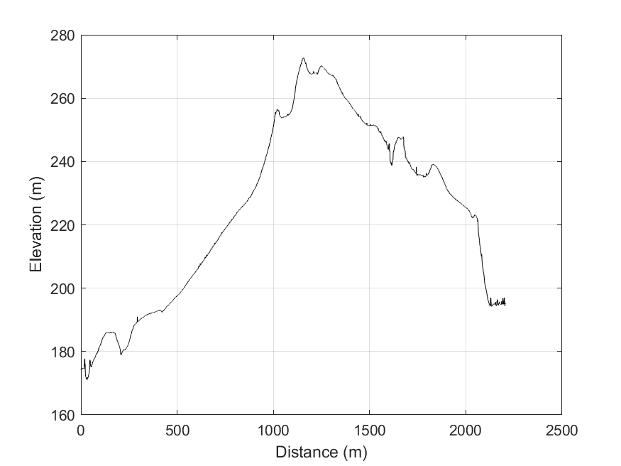
Topographic profile
The video presented above discusses the topographic profile cut from the DEM in ArcMap towards the end. This would be the basis for the geologic cross section, preferably without vertical exaggeration.

Topographic data text file: LINK and MATLAB script to plot it: LINK

2021 ADDENDUM:
For the October 2021 field work, we are trying to use STRABOSPOT for the digital mapping. I prepared a few items to help:
- Simple tutorial. The students need to do all but the very last step (uploading after the field) BEFORE we go to the field: PDF
- Video tutorial. I recorded all of this on the browser and the tablet with narration.
No comments:
Post a Comment
Note: Only a member of this blog may post a comment.